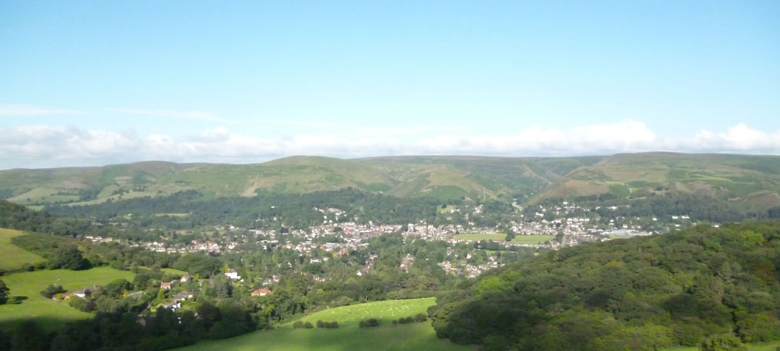
- Snatchfield Farm, Church Stretton is under threat again!
- Planning application 26/00328/OUT
- Building on Snatchfield is an appalling idea!
- Legislation and National Planning Policy
- Legal advice note
- Housing Needs Survey and Neighbourhood Plan
- Community Concerns
- Biodiversity
- Loss of mature trees
- Water quality and sewerage capacity
Snatchfield Farm, Church Stretton is under threat again!
Posted to this website by kind permission of Ron Parnell
Planning application 26/00328/OUT
The application is for residential development of up to 75 dwellings including 33% affordable housing, landscape and biodiversity enhancements, drainage works, and means of access (including demolition of 23 Chelmick Drive). For details, please use the link below and type in the reference number 26/00328/OUT
https://pa.shropshire.gov.uk/online-applications/
The formal comment period closed on 8 April 2026, with a total of 346 public comments made, of which 336 are Objections, four in support and the others neutral. There are 92 documents associated with the application many of which have been submitted by local people.
As of late July, the position is understood to be as follows:
- The applicant is to submit further documents apparently to address the objections;
- These should appear on the Shropshire Planning Portal;
- There will be a further period for comments; for how long and who will be invited to comment is unknown;
- Shropshire Council has indicated that it will not be entering into a Section 106 agreement with the applicant before the application is determined (A Section 106 agreement under the Town and Country Planning Act 1990 is a legally binding contract between a developer and a local planning authority to mitigate the impact of a development and to secure community benefits);
- A recent Court of Appeal ruling established that a Local Planning Authority failing to publish a Section 106 agreement before reaching a decision was unlawful. The Court emphasised that the purpose of such an agreement is to allow public comment and transparency;
- Shropshire Council has failed to keep the key dates for this application current which gives misleading information to the public;
- The Council has said that any recommendation to approve the application will come before its Southern Planning Committee. The dates of Committee meetings can be found here: Browse meetings – Southern Planning Committee — Shropshire Council
- In June 2026, Shropshire Council adopted a Supplementary Planning Document https://next.shropshire.gov.uk/media/g3ohfyew/design-of-new-dwellings-spd.pdf On page 47 it is clear that major development in the National Landscape is defined as 10 or more houses. Initially the Council rejected this definition in respect of Snatchfield
- The applicant or Shropshire Council might argue that there is a compelling “exception” case to approve this major development in the Shropshire Hills National Landscape because there is not a five-year housing land supply in the County;
- However, in the Shropshire Council decision on application 25/04124/OUT for land in Cressage, the case officer judged that the current land supply of 4.61 years was adequate: Committee Agenda
We will endeavour to update the position as and when further information comes to light.
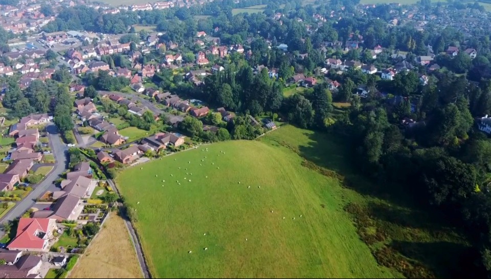
Building on Snatchfield is an appalling idea!
The Snatchfield site was deemed wholly inappropriate for housing in 2021. The arguments to refuse this application have not changed. Indeed, the case against building on Snatchfield is stronger than ever with strengthened protection from the Levelling Up and Regeneration Act 2023 and policies in The Strettons Neighbourhood Plan. Please scroll down to find out more.
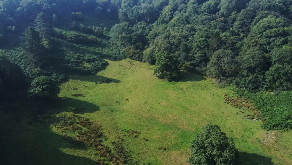
SNATCHFIELD is a peaceful haven for wildlife, comprising wet flushes, a stream and species rich grassland. It sits within a wider landscape of deciduous and mixed woodland, creating a buffer strip between countryside and the townscape.
Legislation and National Planning Policy
“……..it is considered that there is insufficient justification to warrant the allocation of major housing development in Church Stretton, given its location within the Shropshire Hills Area of Outstanding Natural Beauty (AONB) and the need, documented within the NPPF, to demonstrate that exceptional circumstances exist for such major development within the AONB.”
Source: Shropshire Council, Cabinet Paper, 7 December 2020
NATIONAL LANDSCAPES are protected under the Levelling-up and Regeneration Act 2023. Section 245 states that the local authority has a statutory duty and “must attach greater weight to the purpose of conserving and enhancing the natural beauty, wildlife, and cultural heritage of the area”. Paragraphs 189 and 190 of the National Planning Policy Framework (NPPF) support this statement. The NPPF provides protection to National Landscapes – any planning application for a major development should be refused other than in exceptional circumstances.
- Authorities such as Shropshire Council have a legal duty to seek to conserve and enhance the landscape and biodiversity of a protected landscape.
- SAMDev Plan 2025, Core Strategy 2011; Strettons Neighbourhood Plan – any major development outside Church Stretton’s development boundary is contrary to Shropshire Council policies CS5, MD7a, MD12 and S5.1. Inappropriate development outside of the development boundary undermines the wishes of the local population, as expressed in the Church Stretton Town Development Strategy (Policy S5.1) and the Neighbourhood Plan.
National Planning Policy Framework paragraphs 188 and189 relate to National Landscapes.
“In allocating land somewhere like Church Stretton, where it sits in the Shropshire Hills AONB, national policy sets the bar higher with regard to releasing land for significant housing development in those areas.” Mr West added that he was confident that “housing need” in Church Stretton “could be met through smaller, more sensitive developments”.
Source – Shropshire Star, Friday, 27 November 2020, quoting Eddie West, Planning Policy and Strategy Manager, Shropshire Council
Please view the objection lodged by Shropshire Hills National landscape: https://cshousingplans.org/wp-content/uploads/2026/04/shrophills-nat-landscape-obj-re-snatchfields-apr20126.pdf
Legal advice note
Read the legal advice note on the planning application that was commissioned in March 2026.
Housing Needs Survey and Neighbourhood Plan
Church Stretton’s Housing Needs Survey shows residents want 1-2 bedroom homes, for older single households, first time buyers and local people on modest incomes. They do not want more large homes built over the valley and hills around the town. The Neighbourhood Plan addresses these needs, placing emphasis on housing on brownfield sites. Read more about The Neighbourhood Plan.
Community Concerns
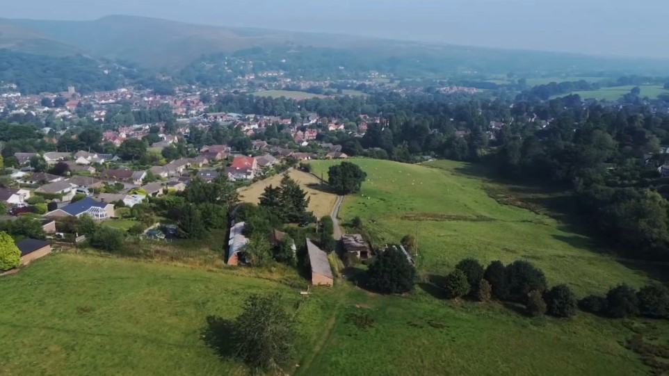
Access to Snatchfield via Clive Avenue, Ragleth Road and Chelmick Drive would generate an estimated additional 500 car journeys per day (excluding deliveries, etc). This would place an unsustainable burden and pose a significant safety risk to residents and visitors alike. The busy A49 junction would be loaded by additional traffic.
VEHICULAR ACCESS
Please click on the link below to read an analysis of Snatchfield traffic and transport issues in regard to the current planning application. It has been submitted to the Shropshire Council Planning Portal and is reproduced here with permission.
We commissioned a technical assessment of the applicant’s Transport Document and the access arrangements for the site in general. Please read the report which was prepared in late February 2026.
Please also see a traffic report produced in May 2026: https://cshousingplans.org/wp-content/uploads/2026/05/traffic-report-may-2026.pdf
National Planning Policy Framework paragraphs 115-117 are clear that development should be refused if the risk to pedestrian safety is severe.
“In essence, the technical exercise (Transport Assessment provided by the prospective developer) has demonstrated there will be significant impact on the local highway network without any consideration for mitigation or improvement, therefore I cannot support this site for future allocation”.
“Clive Avenue has always been the subject of road safety concern. Particularly, in respect to vehicular and pedestrian conflict”,
“Realistic Site? No. The impact on the local highway network is significant and the allocation of the site for housing does not have community support.”
Source – Correspondence between Andy Savage and the Planning Policy and Strategy Team, Shropshire Council – obtained by a Freedom of Information Request and Document ev8
PUBLIC RIGHT OF WAY
Snatchfield is an important access point to the eastern hills, much valued for beauty and quietness. The bridleway is very well used by walkers, horse riders and cyclists.
FLOOD RISK AND CLIMATE CHANGE
Shropshire Council’s Strategic Flood Risk Assessment identifies the site as high risk from the impact of additional housing. The Shropshire and Staffordshire Local Flood Risk Management Strategy, Part 3: Strategic Environmental Assessment for Shropshire Environmental Report, December 2015 states that “flood risk management should be sensitive to habitats and wildlife and sympathetic to landscape character.”
The two videos below (used by kind permission of Philip Povall) were both shot on 15 November 2025, after over a day of heavy rain. The first shows the extent of the ponding in the lowest part of the field – this is the area designated as a green space with benches for leisure and recreational activities! (Wellingtons essential!). The second one shows the surface water flooding around the headwall of the culvert and that the culvert has reached capacity.
Biodiversity
Please read this ecology review undertaken in April 2026: A Review of the Ecological Assessments for Planning Application 26/00328/OUT (by kind permission of Julie Cowley)
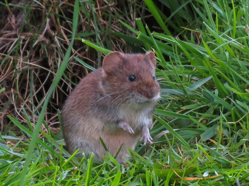
The site is home to priority habitats such as rush pasture and ancient and semi-natural woodland. It supports owls, brown hare, hedgehog, grass snake, six species of bats and otter. Bats and otters are protected species under the Conservation of Habitats and Species Regulations 2017.
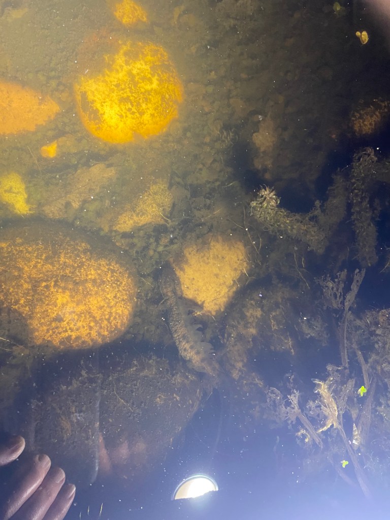
Great crested newts have been found in a pond within 80m of Snatchfield. When they migrate from the pond, their dispersal radius is typically 250m – so they are likely to use the habitat in Snatchfield. They are the rarest of our newts and a protected species. They are included on the list of species of principal importance in England (Section 41, Natural Environment and Rural Communities Act 2006). Shropshire Council must consider the conservation of great crested newts as part of its planning decision. Picture of great crested newt by kind permission of Julie Cowley
Eleven species of bat were recorded between May and October 2025 foraging over Snatchfield. An assemblage of this size is of regional, if not national importance. Among the bats recorded were the Lesser Horseshoe bat and the Barbastelle bat. These bats are protected under conservation regulations and the 2006 Act.
Regulations state that stepping stone features such as watercourses and small woods are essential for migration, dispersal and genetic exchange of wild species. Development would disrupt connectivity of the landscape. The Environmental Improvement Plan 2023 requires public authorities to deliver a Local Nature Recovery Strategy to combat the biodiversity crisis. Paragraph 193 of the NPPF states that if significant harm to biodiversity from a development cannot be avoided (mitigated or compensated for), planning permission should be refused.
Loss of mature trees
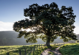
The applicant’s Outline Arboricultural Impact Assessment states that it “can reasonably be expected to lead to the loss of 5 trees and parts of 4 groups, one of which would be high value tree T7 due to the proximity of the proposed road layout.” Tree T7 is the much-loved oak adjacent to the Jack Mytton Way – see picture [opposite] which is reproduced by kind permission of Jim Bunce
Water quality and sewerage capacity
Please read this report of a water quality review undertaken in April 2026. By kind permission of Julie Cowley
 Church Stretton Housing Plans